|
|
||||||||
|
The above links are for my own website. Use the links at the top left, or the back button on your browser to return to the Hill Website. |
||||||||
|
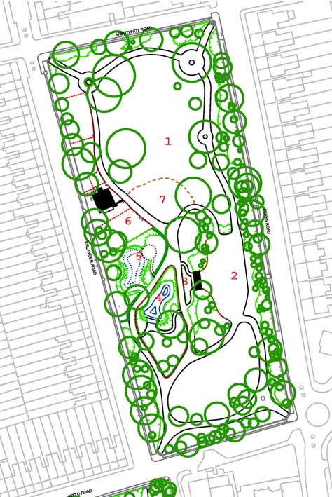
Lower Park Panorama Use the arrow keys or the mouse to pan the picture. This view is taken from the centre of the larger (north) lawn in the Lower Park (point 1 on the map). Works on the trees have taken place by the time this view was taken in March 2004 clearing many of the vistas, but restoration of the paths, ponds and other features had not yet started. Visible in this picture are the childrens play areas (5&6 on map), the (ex-) pond (4), generations playclub (6) and surrounding Erlanger, Arthubnot and Pepys Roads. The lawn is a popular place to read and picnic during the summer months as its west facing slope catches the afternoon and early evening sun. |
||
|
||||||||||